

GLIO: Tightly-coupled gnss/lidar/imu integration for continuous and drift-free state estimation of intelligent vehicles in urban areas
IEEE Transactions on Intelligent Vehicles (2023)
Summary
GLIO tightly couples GNSS, LiDAR, and IMU in a single factor graph for continuous drift-free state estimation in urban areas.
Figures
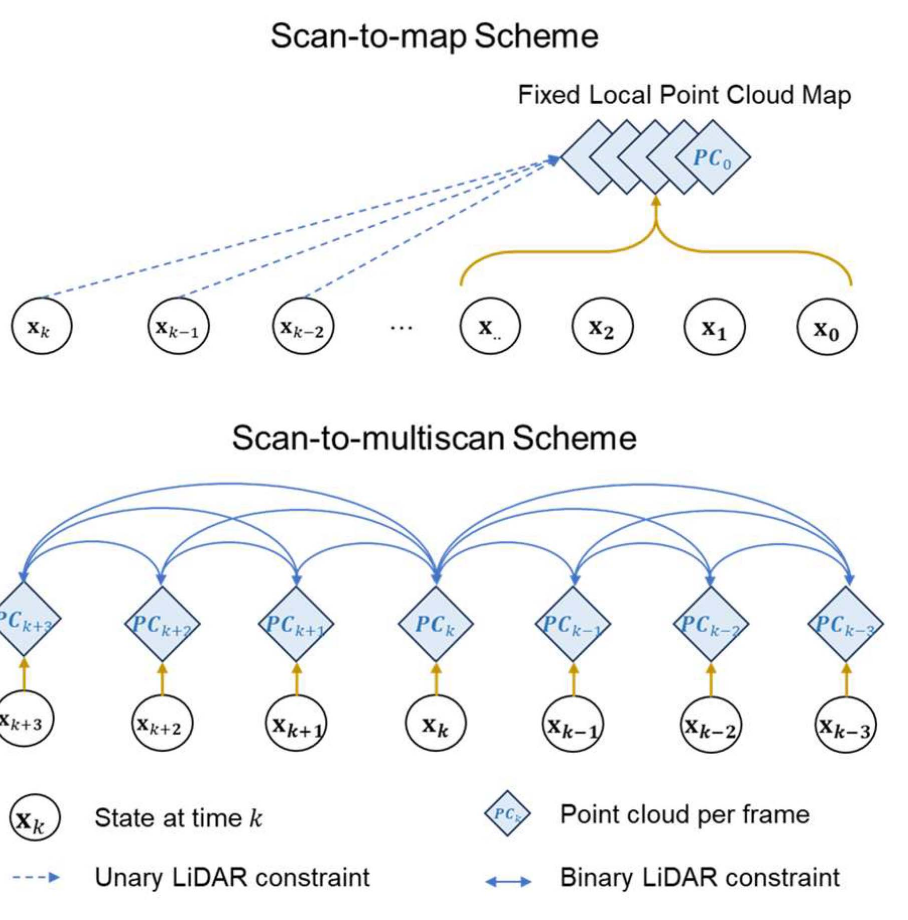
After the system pipeline, this figure explains the LiDAR constraint design that supports smoother and more globally consistent optimization.
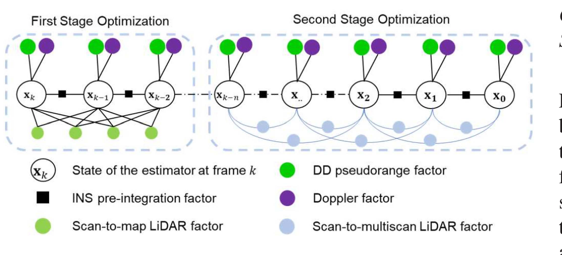
The factor graph shows how GNSS, Doppler, IMU, and LiDAR constraints are organized across the first and second optimization stages.
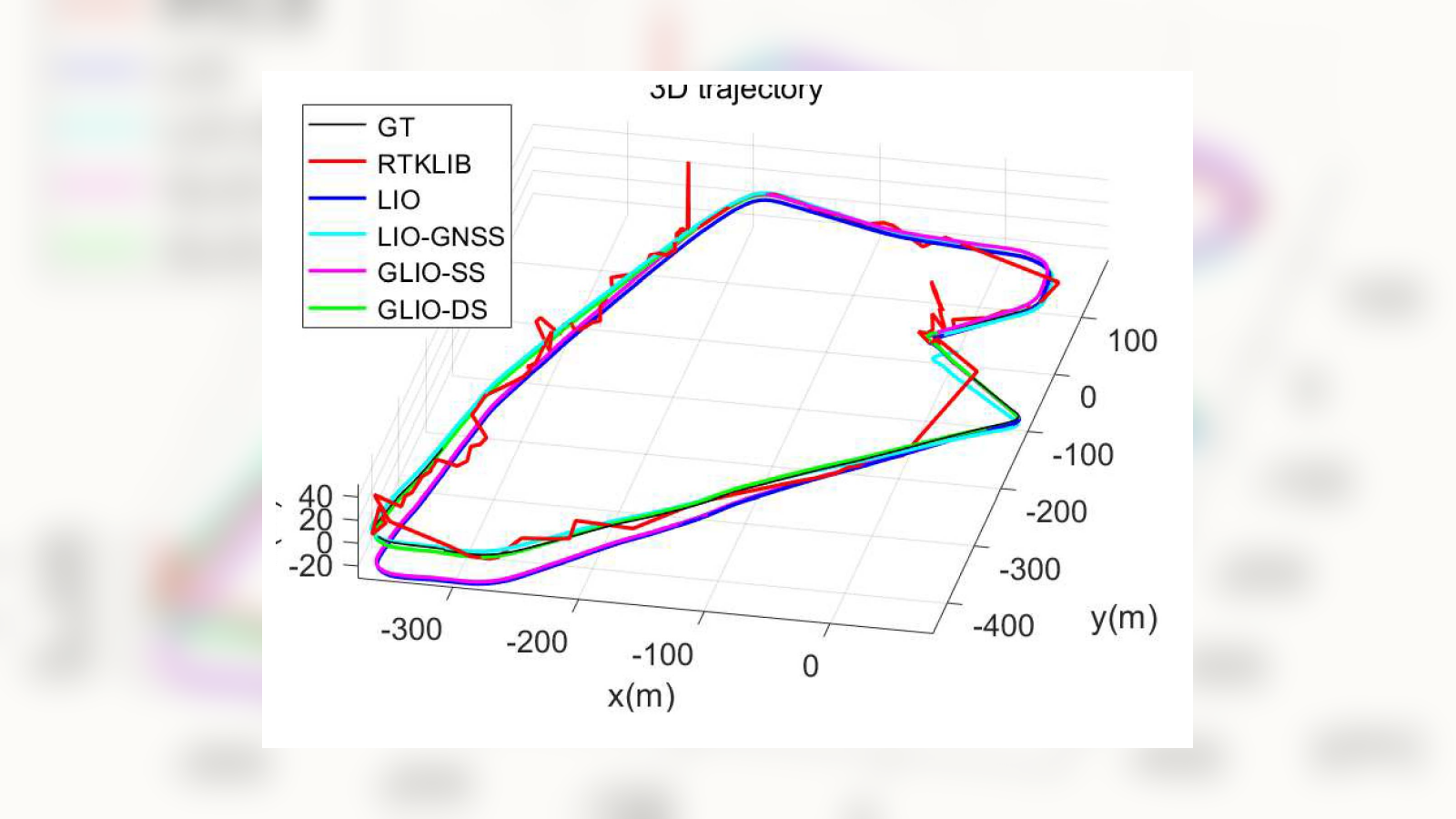
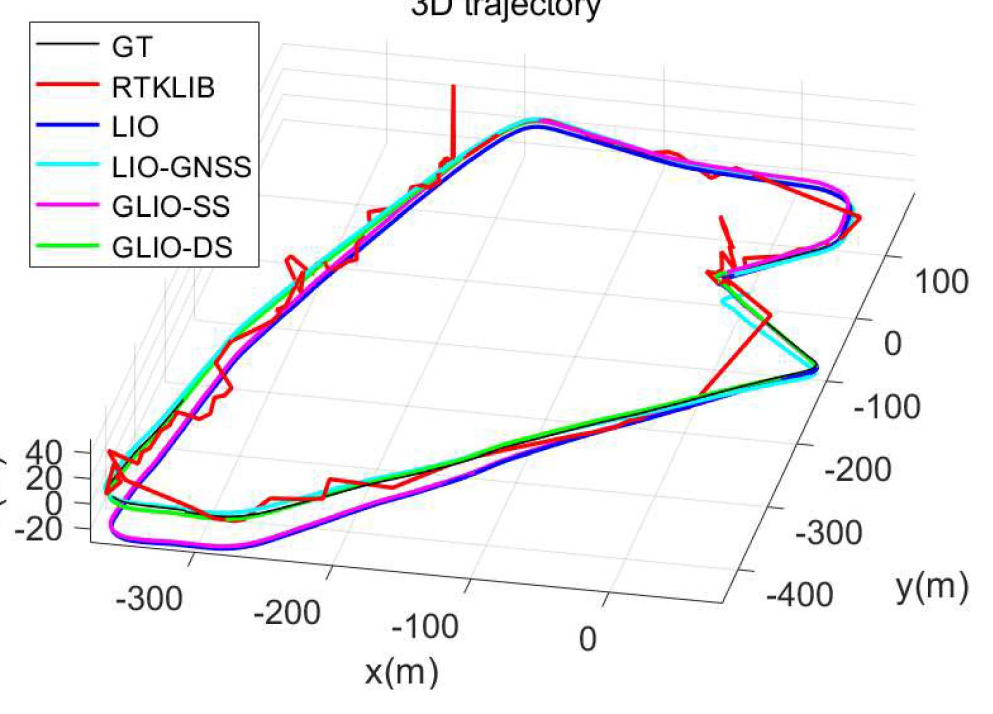
The results begin with the Tsim Sha Tsui sequence, comparing trajectory consistency between GLIO variants and baseline methods.
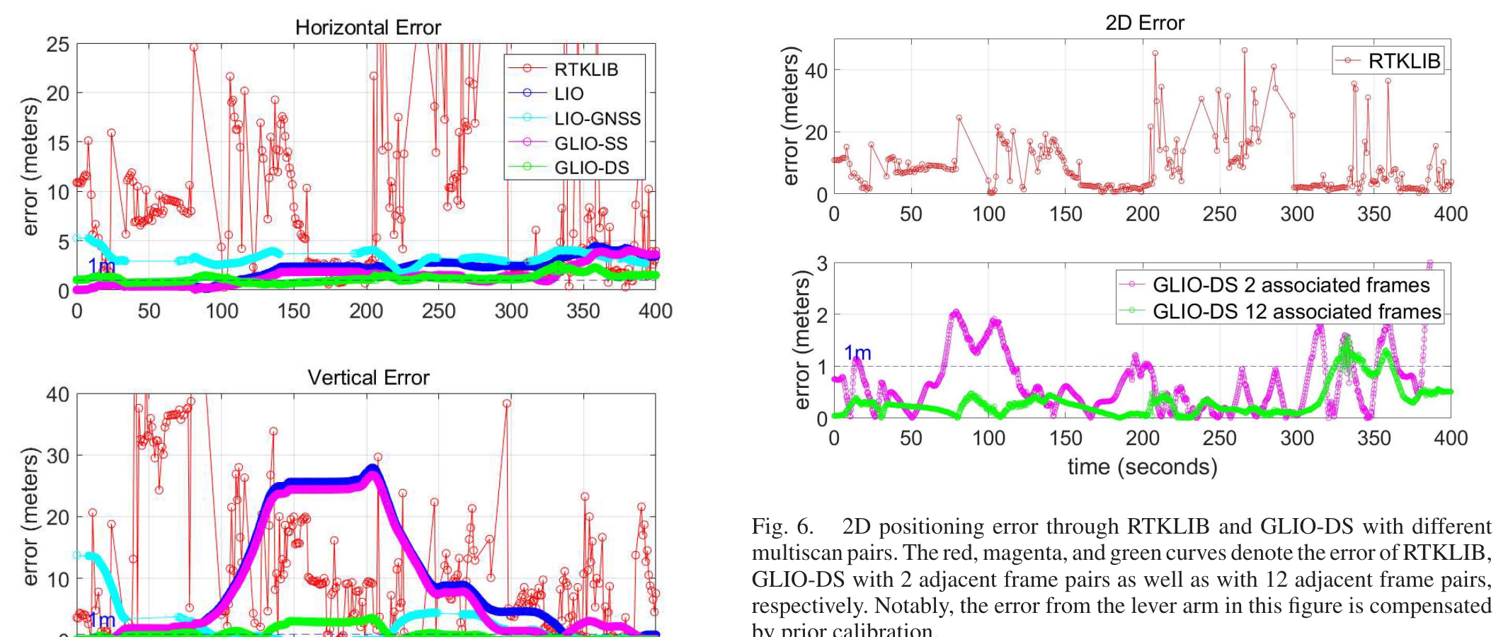
These error plots quantify the same sequence and show where loosely coupled systems degrade while tighter fusion improves.
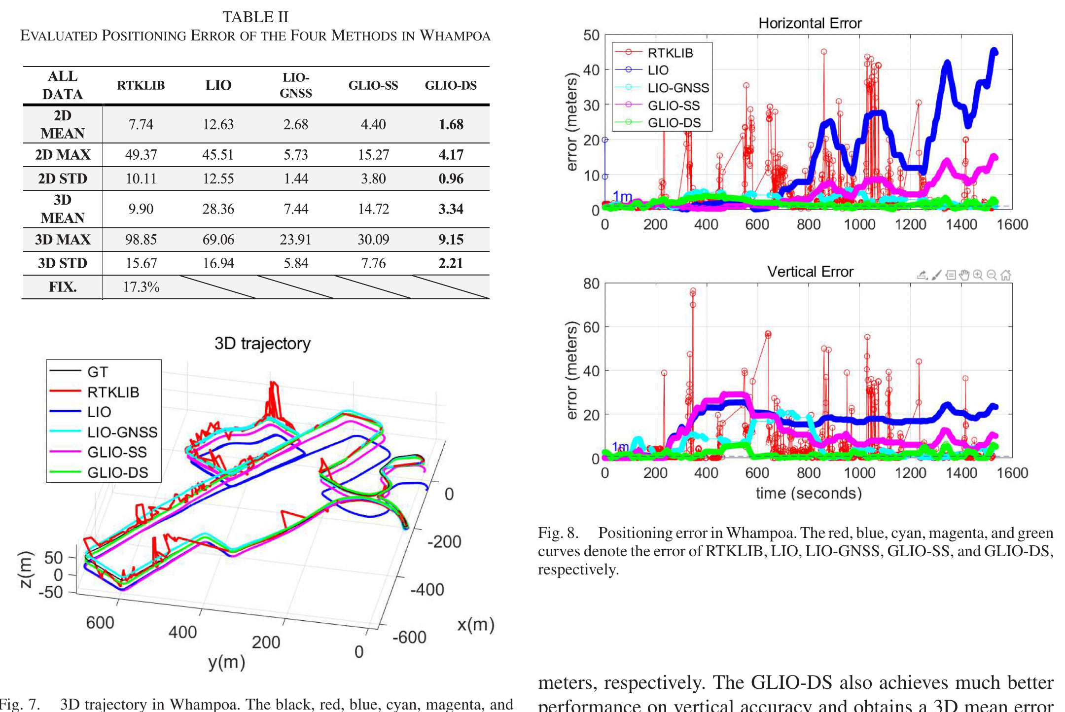
The Whampoa case extends the evaluation to longer dense-urban driving with tunnels, traffic, and severe GNSS/LiDAR challenges.
Key idea. GLIO tightly couples GNSS, LiDAR, and IMU in a single factor graph, so absolute GNSS positioning and drift-free LiDAR-inertial odometry constrain each other — global accuracy without the long-run drift of LiDAR-only systems.
Impact. Delivers continuous, drift-free state estimation for intelligent vehicles across urban areas, and is a flagship example of the lab’s multi-sensor fusion stack for real platforms.