Factor Graph Optimization for GNSS/INS Integration: A Comparison with the Extended Kalman Filter

Wen, W., Pfeifer, T., Bai, X., Hsu, L. T.

NAVIGATION: Journal of the Institute of Navigation (2021)

journal Q1 精選頁面
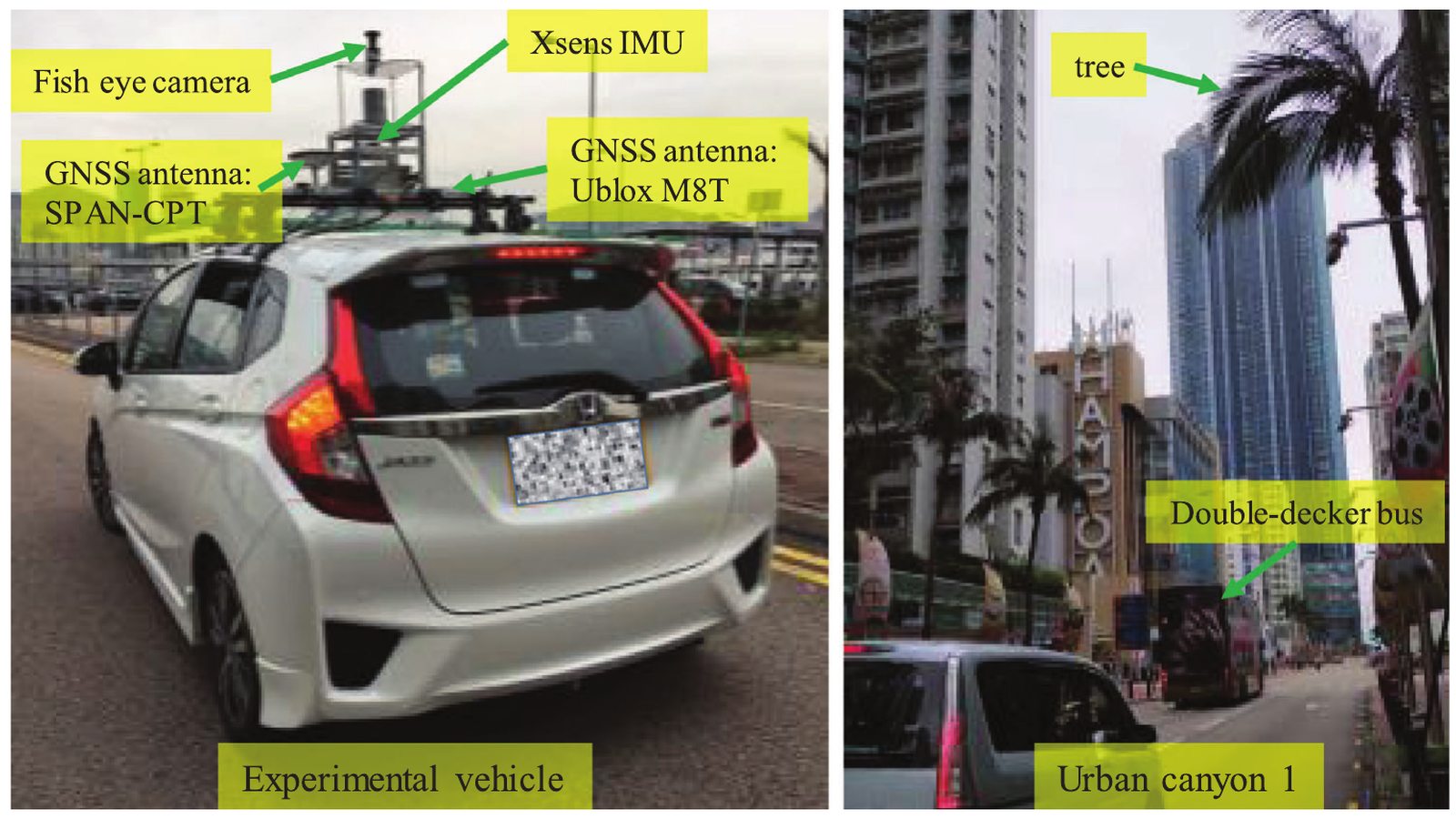
用於 GNSS/INS factor graph 實驗的測試車輛與 urban canyon 場景。
圖 3 視覺細節:測試車輛與 urban canyon 實驗設置,用於比較 FGO 與 EKF。

圖像

在提出因子圖模型前,論文先建立 EKF 的鬆耦合與緊耦合基線,作為新 formulation 的比較對象。
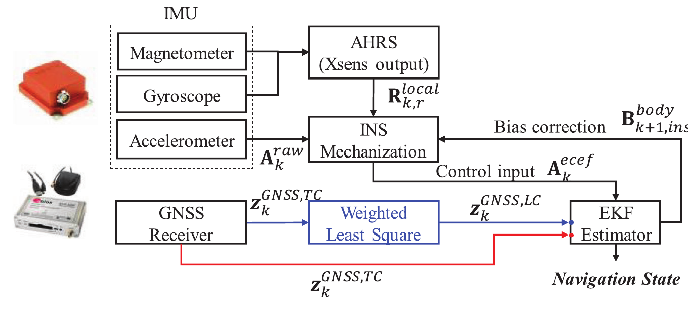
Flowchart of loosely coupled and tightly coupled GNSS/INS integrations implemented using EKF.
圖 1(論文):基於 EKF 實現的鬆耦合與緊耦合 GNSS/INS 整合流程圖。

在定義估計結構後,論文轉向香港車輛實驗平台和城市峽谷路線,用於比較 EKF 與 FGO。
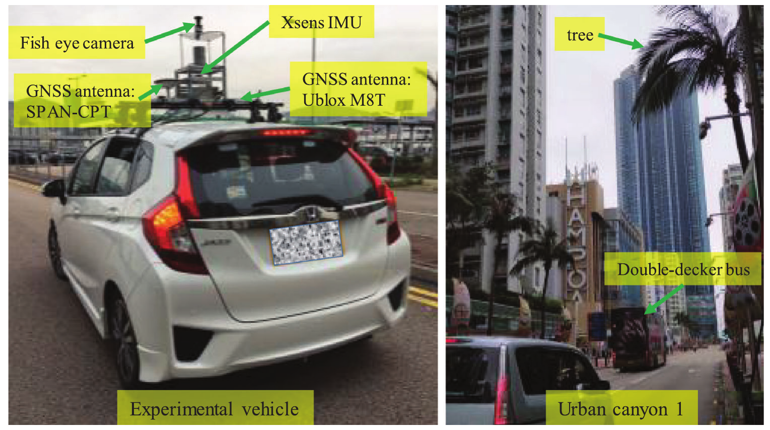
Experimental vehicle sensor setup and Hong Kong urban canyon test scene.
圖 3(論文):實驗車輛感測器配置和香港城市峽谷測試場景。

第一組主要結果把方法轉化為軌跡證據,對比緊耦合 EKF 和 FGO 與參考軌跡的差異。
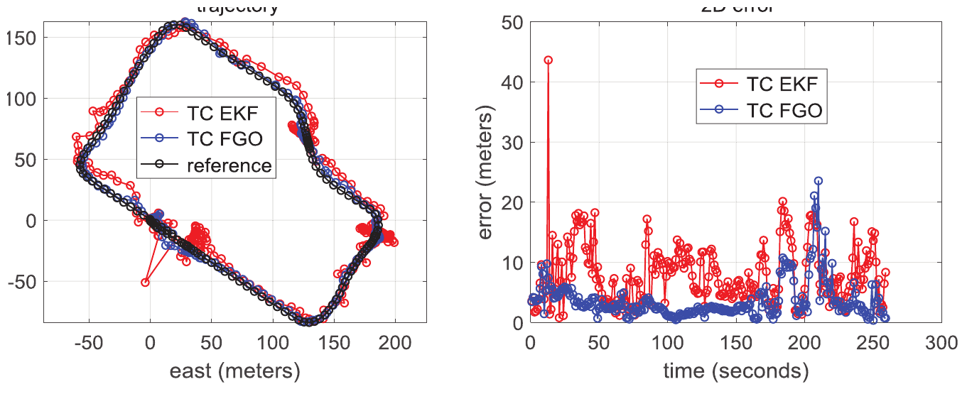
Tightly coupled GNSS/INS trajectory and two-dimensional error results comparing EKF and FGO.
圖 5(論文):緊耦合 GNSS/INS 軌跡以及 EKF 與 FGO 的 2D 定位誤差比較。

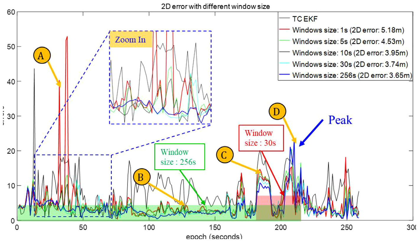
視窗長度分析說明 FGO 的性能為何取決於同時最佳化多少歷史資訊。

Two-dimensional positioning error under different FGO window sizes.
圖 8(論文):緊耦合 FGO 在不同滑動視窗長度下的 2D 定位誤差。

這些天空視圖時刻透過展示困難時段的 LOS/NLOS 衛星條件來解釋視窗長度結果。
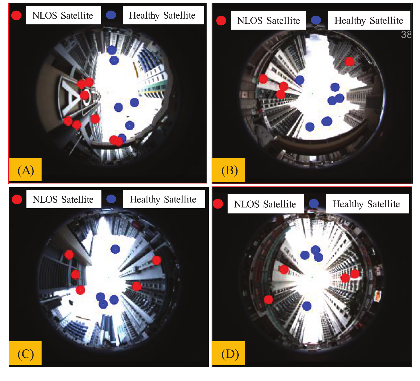
Sky-view images showing line-of-sight and non-line-of-sight satellite visibility at selected epochs.
圖 9(論文):魚眼天空視圖和所選時刻的 LOS/NLOS 衛星可見性。

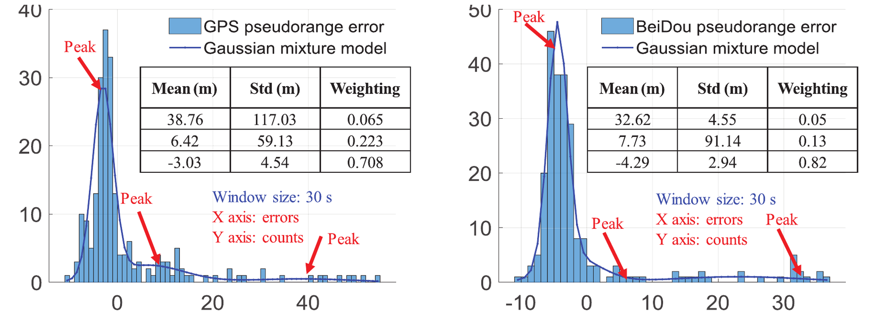
偽距直方圖把定位表現與城市測量雜訊的非高斯特性連結起來。

GPS and BeiDou pseudorange error histograms with fitted Gaussian mixture models.
圖 10(論文):GPS 和北斗偽距誤差直方圖及對應的高斯混合模型擬合。

最後的比較檢查用 FGO 與 iSAM 求解緊耦合圖最佳化的實際計算代價。
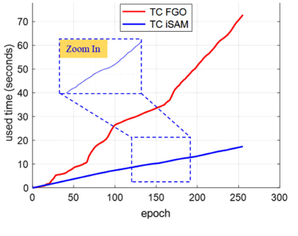
Computational time comparison between tightly coupled FGO and tightly coupled iSAM.
圖 13(論文):緊耦合 FGO 與緊耦合 iSAM 的計算時間比較。