PositionNet: CNN-based GNSS positioning in urban areas with residual maps

Xu, P., Zhang, G., Yang, B., Hsu, L. T.

Applied Soft Computing (2023)

journal Q1 精選頁面
顯示 PositionNet solutions 與 ground truth 的香港路線地圖。
圖 4 視覺組合:香港路線地圖顯示 PositionNet solutions 與 ground truth 的對比。

圖像

在 CNN 架構之前,論文先定義衛星距離殘差如何變成圍繞最小平方法解的影像式輸入。
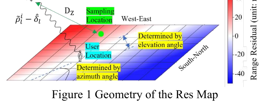
Geometry of the range residual map with satellite direction, sampling location, and user location.
圖 1:PositionNet 輸入殘差圖的幾何關係。

SDRes 圖透過與主衛星做差來去除接收機鐘差,為網路形成更清晰的位置模式。
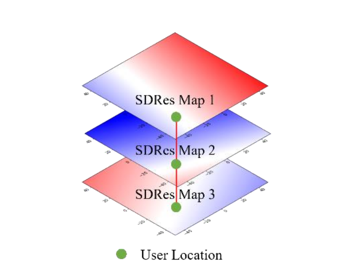
Single-differenced residual map layers intersecting at the user location.
圖 2:當多個 LOS 衛星一致時,SDRes 圖會強化位置模式。

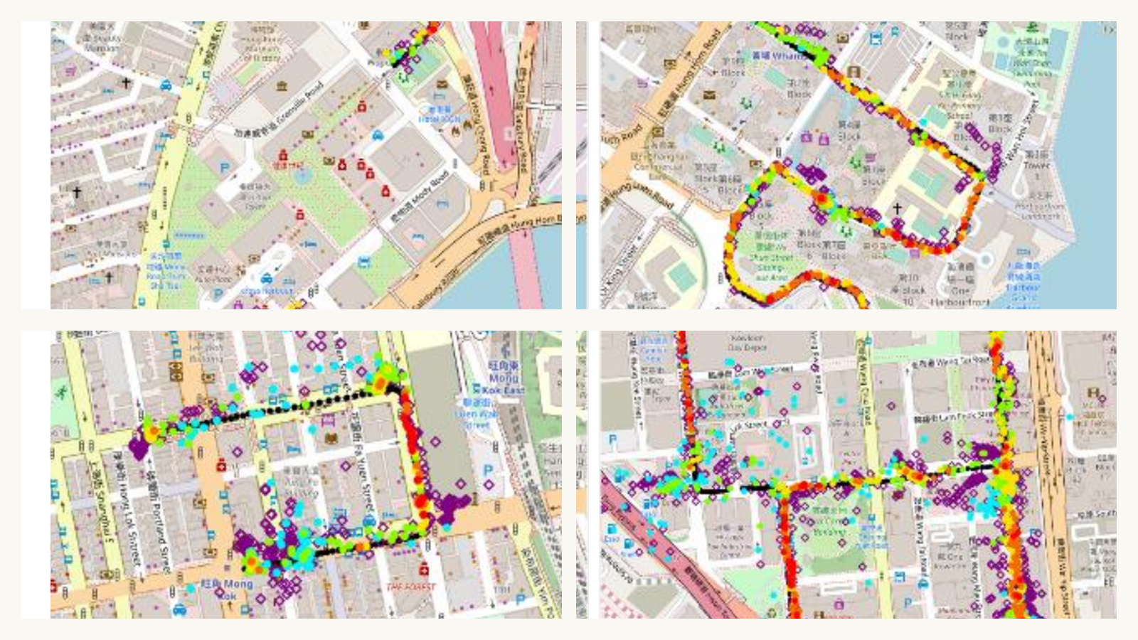
第一組結果把 PositionNet 輸出映射到多個城市區域,展示其在單一場景之外的驗證和測試表現。
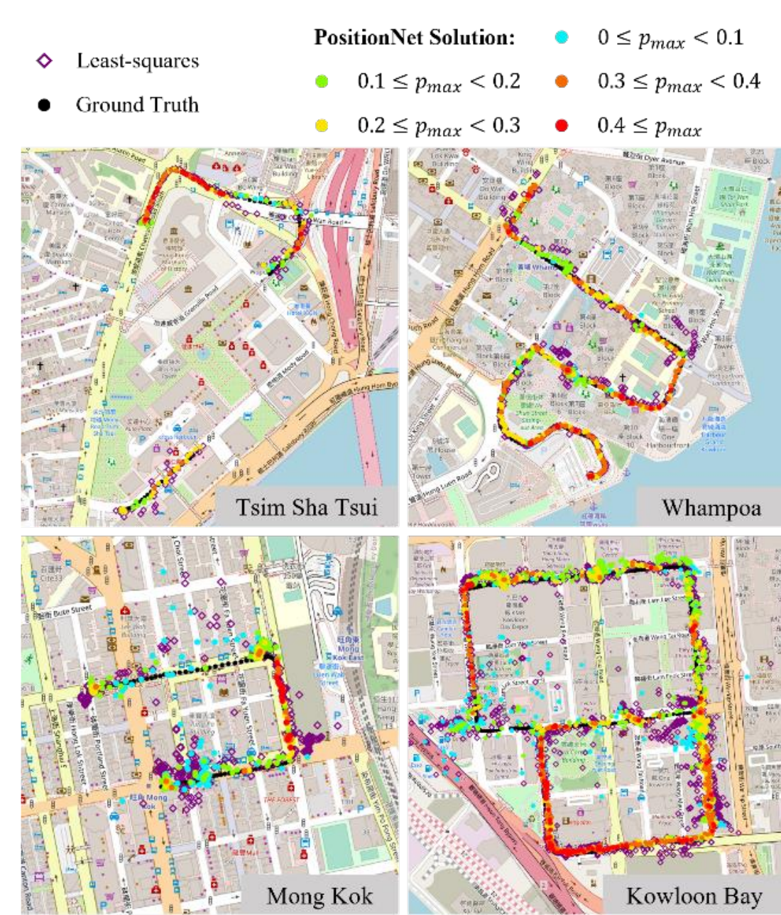
Validation and testing PositionNet results over Tsim Sha Tsui, Whampoa, Mong Kok, and Kowloon Bay maps.
圖 4:顯示在城市地圖上的驗證和測試結果。

案例研究進一步放大一個最小平方法誤差較大的樣例,展示輸出熱力圖如何指向修正後的位置。
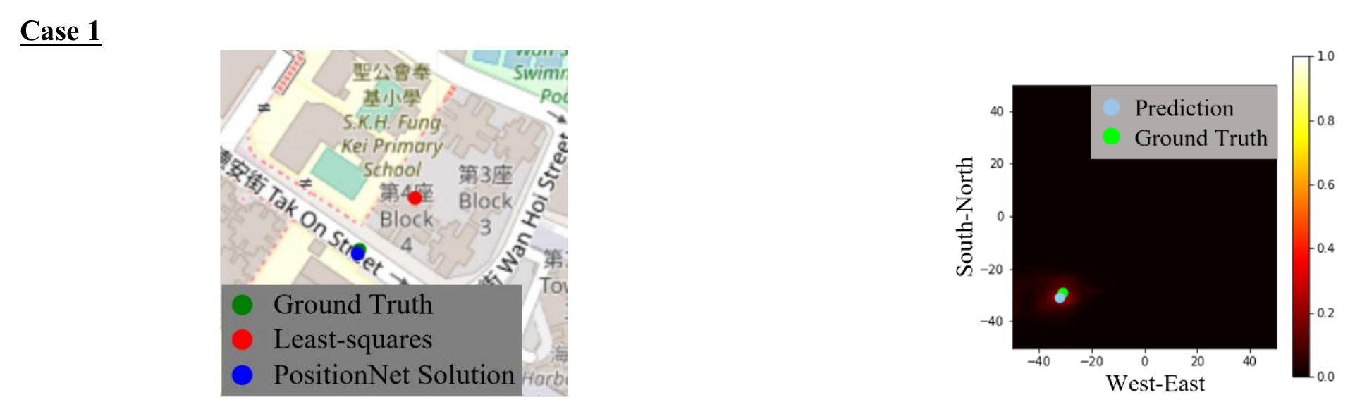
Case 1 PositionNet solution map and output heat map.
圖 5:案例 1 的定位解和輸出熱力圖。

顯著性圖解釋該案例中哪些衛星殘差、SDRes 和 C/N0 圖層影響了網路判斷。
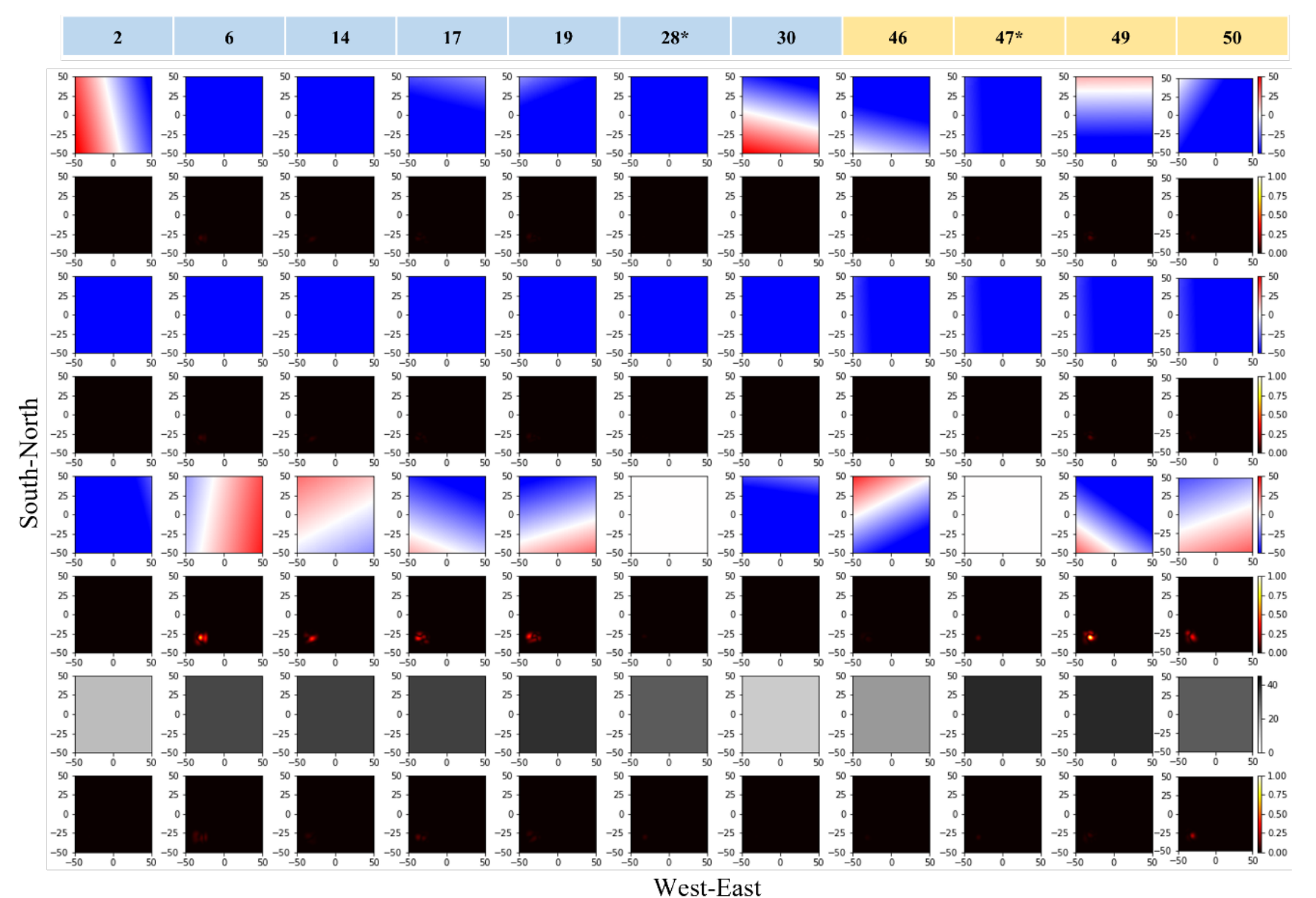
Case 1 saliency map grid showing residual maps, SDRes maps, C/N0 maps, and saliency responses.
圖 6:案例 1 的顯著性圖,解釋哪些衛星殘差模式影響了網路。

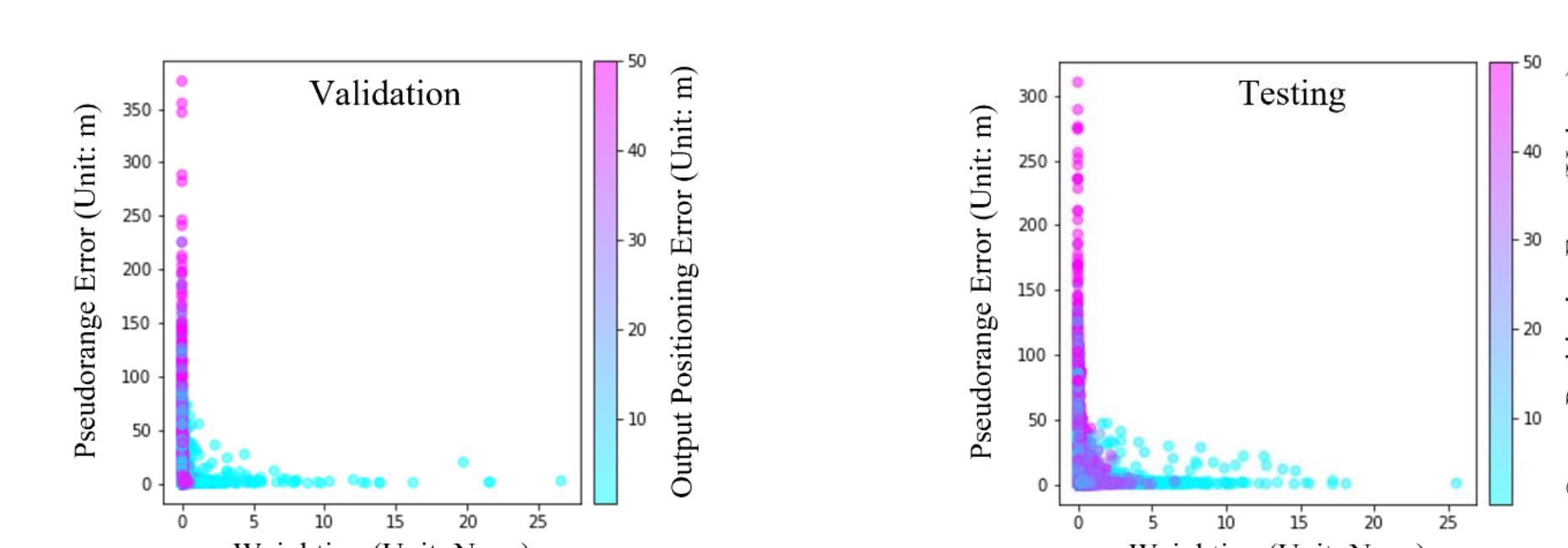
彙總顯著性圖把案例級解釋擴展到驗證和測試資料中的測量品質。

Scatter plots of saliency map weighting versus pseudorange error for validation and testing data.
圖 11:驗證和測試資料中顯著性圖權重與偽距誤差的關係。